 |
| Route and section - not quite the intended Jack and Grace Cotton Audax |
So there I am this morning driving to Clevedon to the club ride thinking as to whether doing the Audax was actually a better idea. I could see from the motorway that it was raining in Clevedon. Decision made.
I got signed in just in time to have missed a wave of starters with 20 minutes to go before the next group left. I decided to go on my own - I'd doubtless be on my own for most of the day, I might as well start like that as well. Feeling good. Wind at back, flat road, 20+ mph and I started reeling people in. Going well. Arrived at the first check-point. Fortunately there were others there as, due to complete inexperience of audax rides, I had no idea what to do. I didn't have my glasses either so I couldn't read the writing on the card. Some friendly guy sorted me out with a pen and I wrote the last post time from the postbox which he said I should. He could have told me to write down which royal's crest was on the front. I'd have been no wiser, but fortunately audax folk aren't like that, it seems.
Lovely flattish roads heading north through south-west Gloucestershire. What a route! Pretty villages, open countryside, wind behind. More 'others' getting reeled in. Arrived in Berkley. Popped in the grocers to borrow a pen to write down the name of the cafe on the corner (friendly guy had also told me I needed to do this). Conversation in the grocers turned to how far; "60 miles! - I 'm jealous that you can" says a lady customer - who I then get to read the next instruction to me which says I have to stop at a 'sign in' in Epney after 48km. Good, good. Where in Epney? Nothing on the card; should have the course notes for that and of course, given the late decision to ride the audax, I hadn't got them.
Nice person number 4 helped me out. I reeled in a fellow audaxist and asked him if he knew where we were stopping. "Pub. In Epney. Anchor I think. You'll see the bikes outside". With that we parted. It was 'The Anchor'. There were cyclists. Signed in, washed the outside of my bidons off, as they were now carrying about the same weight as one of my cycling shoes in mud, and carried on. The route was now across the wind and therefore a bit slower. But not much - still going well.
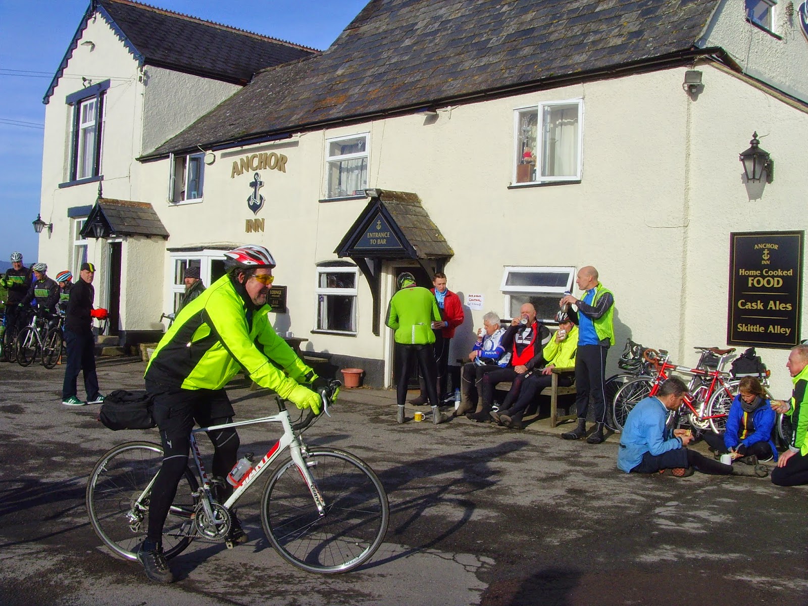 |
| The Anchor at Epney - with cyclists |
 |
| Lost in Quedgley |
Now at this point you might think that I'd cycle with these folk with a view to being certain of the route. I meant to. I didn't work. For the first of a number of occasions from that point of the ride I found that I'd left them (and subsequently others) behind fairly quickly - but I had a strong purple line so I wasn't too worried. I certainly wasn't concerned enough.
It all went swimmingly well as far as the next sign in point - a farm shop cafe. You can see where it is on the section at the top of the blog - the spiky bit at 92km. Where I left the route in the final section I don't know. I was happy that I was following a purple line except that I got to a junction and had a choice or orange roads; not good. I hung around for a while to see if anyone would ride past; surely someone would - then I could just follow them. No one did. They wouldn't though would they. They were on the right route.
Nice person number 5, an elderly lady who lived at the house on the junction, was happy to direct me towards Aztec West (where I'd started from) though not entirely sure of the roads towards the end. It worked. All I needed was nice person number 6 to give me the final directions. Back. Arrived. Hooray. It's all closed! Bad! Arrives nice person number 7, one of the riders of the audax,who was happy to direct me to the signing off check-point, just about a mile away the other side of the M5.
Perhaps I will learn the lesson. The route was supposed to be 64 miles, I did 71. In Quedgley I must have taken a 'long cut' as I got to the farm shop cafe 4 km too late. From there it was supposed to be about 20 km, By the time I'd been to the last check-point and back again I did 32. On the plus side I'd powered round the 71 miles I'd ended up doing with a very few cyclists going past me and then staying in front of me all day. Of course, they didn't get the chance at the end.
For the record there's rather less of Gloucestershire now than there was this morning. I brought quite a bit of it home attached to my bike, me, my helmet, bidons... My wife just emerged from the bathroom. She says that 'The next time I come home wearing Gloucestershire could I please spend longer rinsing down the bath". Seems fair.